How it works Try a lens The library Explore Get started FAQ Download on the App Store →

PRINTABLES

Europe geography printables

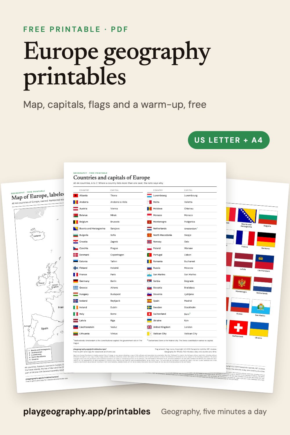
A free unit pack for Europe: blank and labeled maps, all 44 countries and capitals, every flag and a five minute warm-up, each with an answer key. US Letter and A4.

Europe geography printables: preview of the printable sheets

In this pack

  • Blank and labeled maps of Europe.
  • All 44 countries and capitals, with a worksheet.
  • All 44 flags, with a worksheet.
  • A five minute warm-up with answer key.
  • Every sheet in US Letter and A4.

Maps

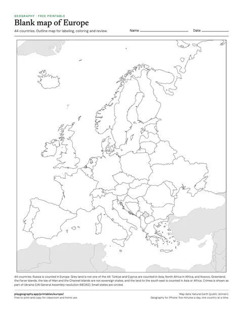
Preview of the Blank map of Europe sheet

Blank map of Europe

Outline map of all 44 countries of Europe, no labels. For labeling, coloring and review. 1 page.
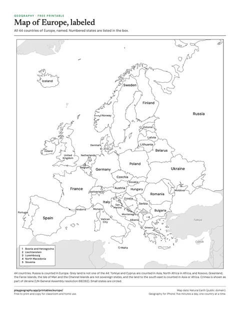
Preview of the Map of Europe, labeled sheet

Map of Europe, labeled

Every country of Europe named on the map. Use it as the answer key for the blank map. 1 page.

Countries and capitals

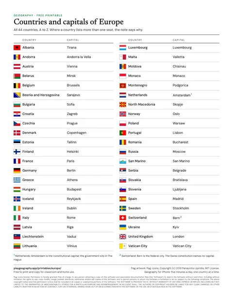
Preview of the Countries and capitals of Europe sheet

Countries and capitals of Europe

All 44 countries of Europe with their capitals and flags, A to Z, on one page. 1 page.
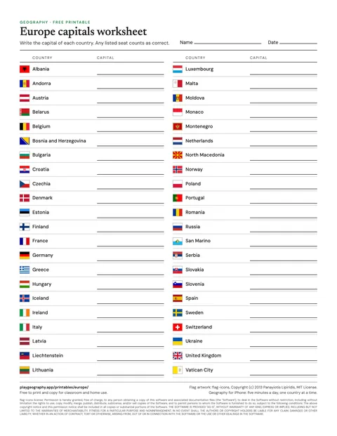
Preview of the Europe capitals worksheet sheet

Europe capitals worksheet

Write the capital of each of the 44 countries. Page two is the answer key. 2 pages.

Flags

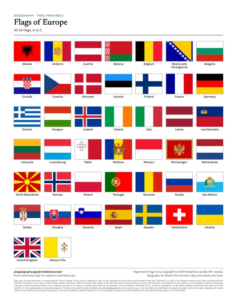
Preview of the Flags of Europe sheet

Flags of Europe

All 44 flags of Europe, named, in alphabetical order. 1 page.
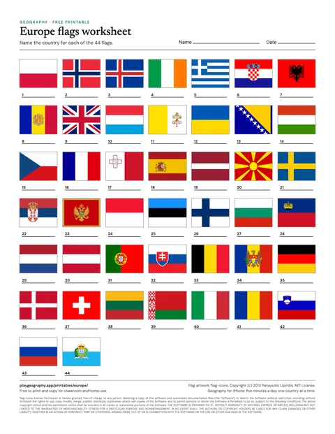
Preview of the Europe flags worksheet sheet

Europe flags worksheet

Name all 44 flags, in shuffled order. Page two is the answer key. 2 pages.

Five minute warm-up

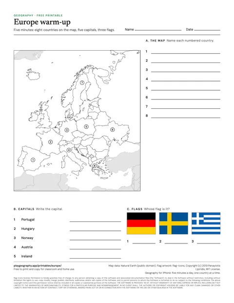
Preview of the Europe five minute warm-up sheet

Europe five minute warm-up

Eight countries to find, five capitals and three flags. Page two is the answer key. 2 pages.

How the sheets count Europe

Every sheet in this pack counts 44 countries in Europe, read from the same list as the rest of playgeography.app: the 193 UN member states and two observer states, each filed under one continent by the UN geoscheme. Russia is counted in Europe. Türkiye, Cyprus, Georgia, Armenia, Azerbaijan and Kazakhstan are counted in Asia, which is why published counts for Europe run from 44 to about 50. Kosovo is drawn but not counted, and Crimea is drawn as part of Ukraine. How many countries are in Europe? goes through the count in full.

A simple plan for a unit

  1. Start with the warm-up, without notes, to see what the class already knows.
  2. Work through the labeled map together, then hand out the blank map to fill in.
  3. Use the countries and capitals sheet as the reference for the week.
  4. Finish with the capitals and flag worksheets, and mark them with the answer keys.

Common questions

How many countries are in Europe?
44, on these sheets. That is the count you get by filing each of the 193 UN member states and two observer states under one continent, following the UN geoscheme. Other conventions give different totals, and the page How many countries are in Europe? on this site explains why.
Why does the Europe sheet have 44 countries and not 50?
Because each country is counted on one continent only. Russia is counted in Europe, while Türkiye, Cyprus, Georgia, Armenia, Azerbaijan and Kazakhstan are counted in Asia, following the UN geoscheme. Counting those six in Europe as well, as some atlases do, gives a figure of about 50.
Are these printables really free?
Yes. Every sheet is a free PDF with no sign up and no email address. You may print and copy them for your own classroom, homeschool or family. Each one comes in US Letter and A4, and the worksheets carry their answer key on the last page.
How do I print them so nothing is cut off?
Download the PDF that matches your paper, US Letter or A4, and print at actual size or 100 percent. Every sheet keeps half an inch of margin on all sides, so ordinary home and school printers reach every line. The maps print well in black and white; anything with flags needs color.

Keep exploring